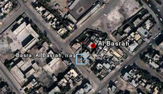
The Telegraph reports that terrorists from Iraq use Google Earth "to pinpoint their attacks".
The satellite photographs show in detail the buildings inside the bases and vulnerable areas such as tented accommodation, lavatory blocks and where lightly armoured Land Rovers are parked.
Written on the back of one set of photographs taken of the Shatt al Arab Hotel, headquarters for the 1,000 men of the Staffordshire Regiment battle group, officers found the camp's precise longitude and latitude.
"This is evidence as far as we are concerned for planning terrorist attacks," said an intelligence officer with the Royal Green Jackets battle group. "Who would otherwise have Google Earth imagery of one of our bases?"
Google Earth's imagery is not very recent, as sometimes images are two or three years old, but even those images can be useful. Google already blurs the US Congress, vulnerable places from Israel, and other sensitive sites.
As Google Earth starts to include more high-resolution images, these requests will be frequent. Some will say Google Earth's censorship is necessary, but it's difficult to draw the line between the accessibility of public information and security risks. Google search can also reveal vulnerabilities and confidential documents.
Military troops should be prepared to face more knowledgeable enemies, because those who want to get satellite imagery or other kinds of information will get them, even if they have to pay for that.
Homework:
1) Do you think it's OK to censor Google Earth's imagery?
2) Do you know other famous places that appear blurred in Google Earth?


